Abstract
Uses three-dimensional scanning and UAV photogrammetry to examine how construction units, three modular levels and square-circle geometry govern plan, elevation and interior space.
Uses three-dimensional scanning and UAV photogrammetry to examine how construction units, three modular levels and square-circle geometry govern plan, elevation and interior space.
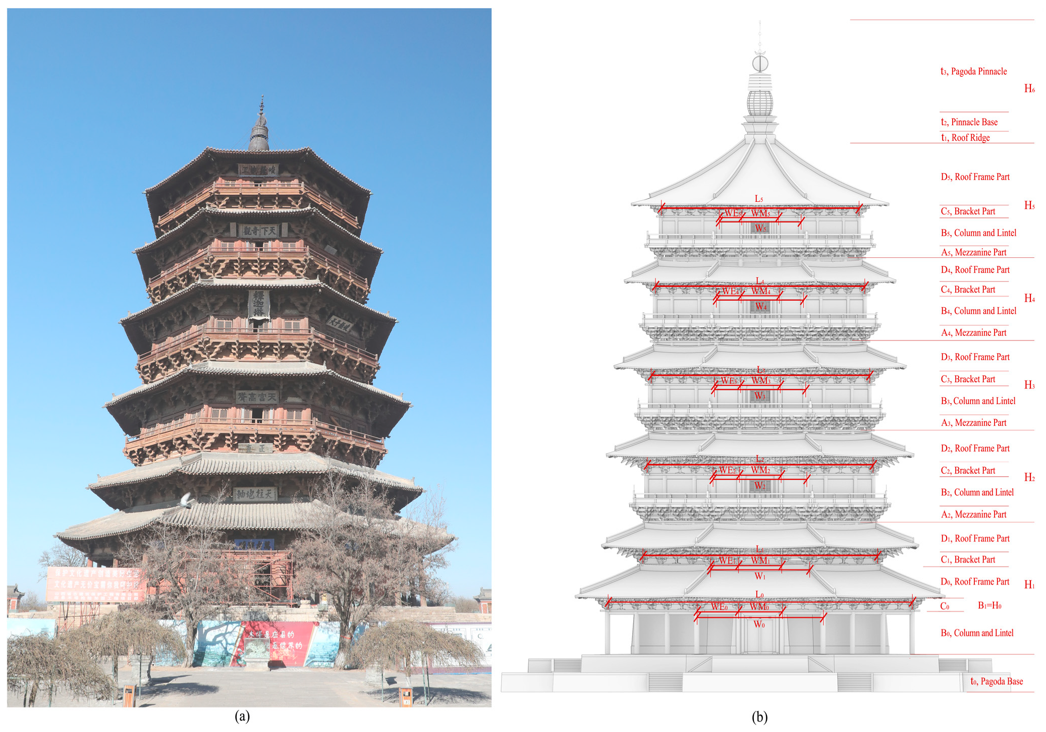
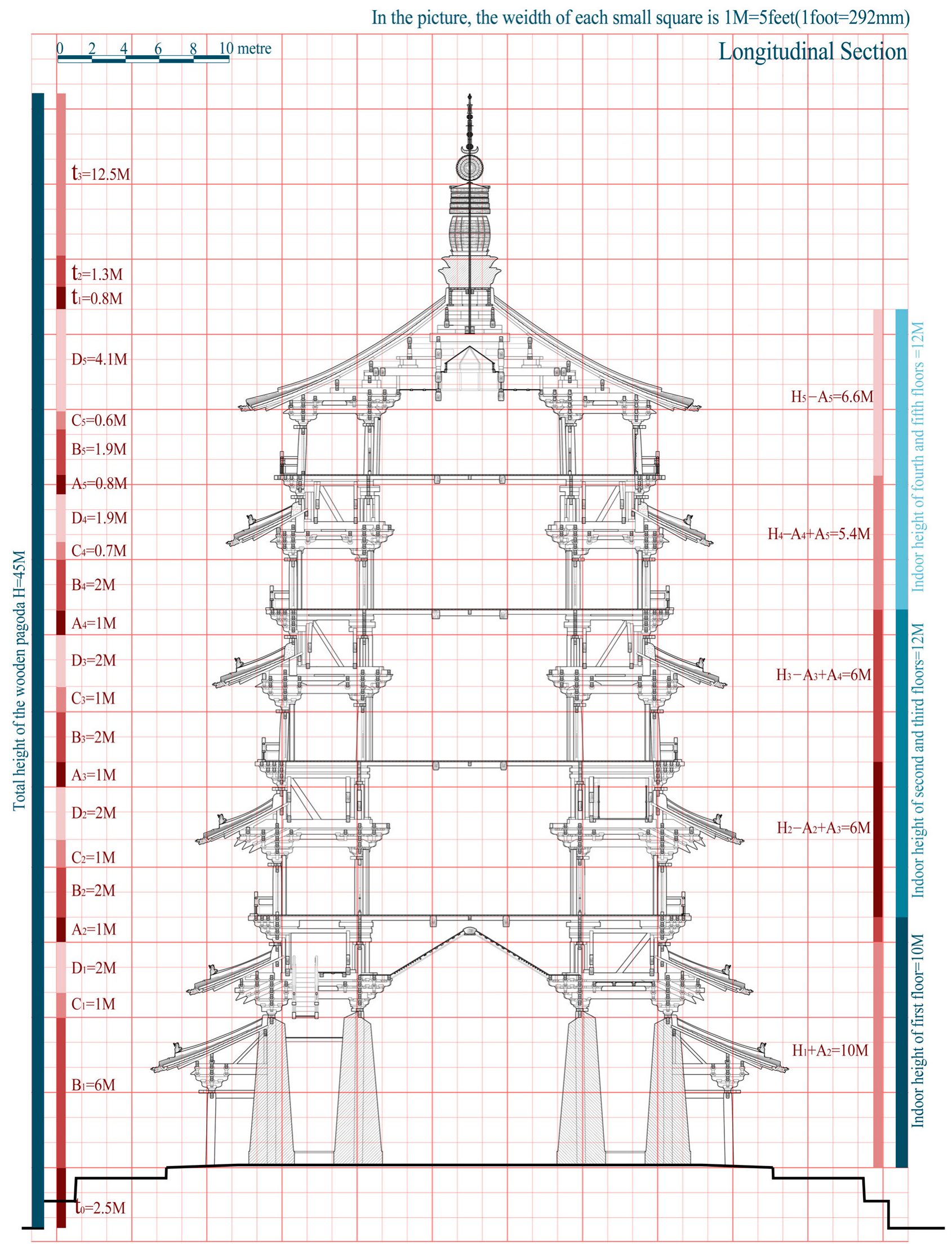
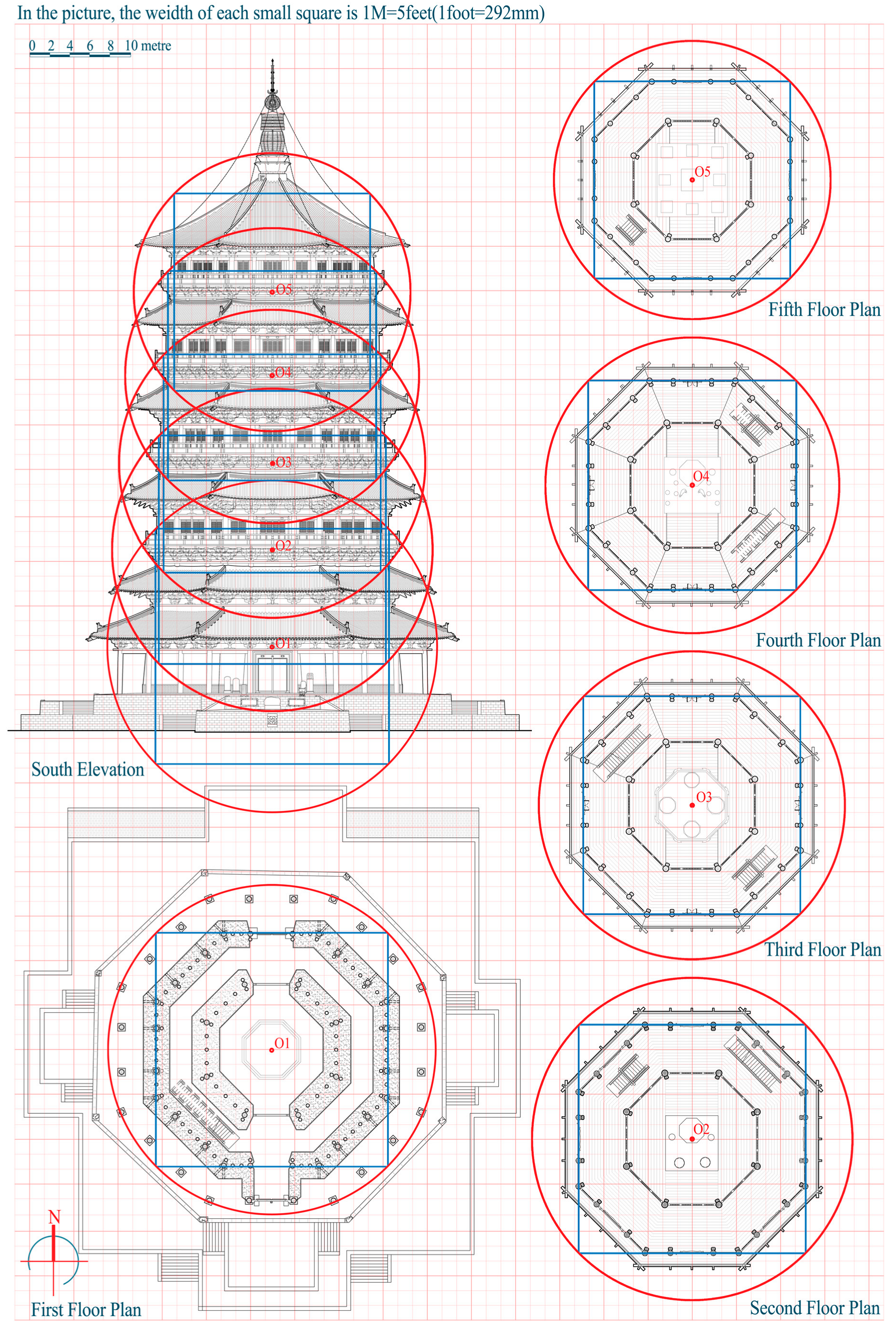
Uses three-dimensional scanning and UAV photogrammetry to examine how construction units, three modular levels and square-circle geometry govern plan, elevation and interior space.